Quality Assurance Software
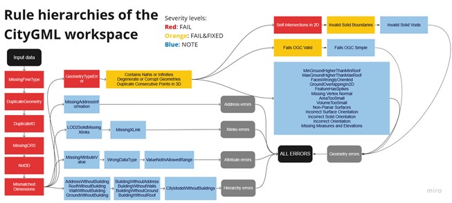
For this project, I have developed a pilot software for data quality assurance of 3D buildings. The software checks the CityGML and CityJSON formats againts pre-defined quality rules and creates an output report containing all founded violations in the tabular or geometrical format. Totally the software contains over 40 quality...
A European undertaking for the effective use of geospatial data
Launched at the end of 2020, the Geospatially Enabled Ecosystem for Europe (GoeE3) project aims to improve the accessibility and interoperability of geospatial data. The project will cover various areas that have not previously been tested in the geospatial data sector. One of the goals of the GeoE3 project is to develop...
GeoE3 Service Architecture
Geospatially Enabled Ecosystem for Europe, GeoE3, is a project co-financed by the Connecting Europe Facility of the European Union that will provide the vital connection between existing and emerging National, Regional and Cross-Border digital services. The action provides dynamic integration of high-value data sets and services (e.g.,...
