
The Location Europe data integration platform (previously known as GeoE3 platform) provides harmonised location data from different countries across Europe. This internationally significant project will make it possible to combine datasets from various countries and makes the data easier to access.
For example, it contains data on buildings and average temperatures in five different countries. Our goal is to expand the service with new datasets from other countries.
Three-dimensional data to support decision-making
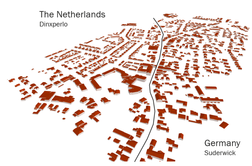
One of the platform’s most interesting features is the possibility to view building data from different countries in 3D form.
“Visualised, three-dimensional data may be helpful for municipal decision-makers to perceive what a new building might look like or how it might affect its environment, for example. This way, it will be possible to design more functional, smarter cities,” says project manager Antti Jakobsson from the National Land Survey of Finland.
Location Europe combines data from different countries, which gives businesses the opportunity to scale up their services to the European market from the get-go. For example, they can review building data seamlessly across borders. Combining datasets is most useful in European countries with long, common borders with citizens that travel flexibly between both countries.
“The platform is an excellent tool for a situation in which you want to analyse your environment in a three-dimensional fashion. Let’s take a solar energy business – with this, they will be able to assess the buildings’ solar energy potential in different countries. If this data was available for all of Europe, this service could have enormous business potential,” says Jakobsson.
The potential of the platform has already been identified, as the Finnish Innovation Fund Sitra highlighted it on their list of most interesting data economy solutions in 2023.
Cross-border cooperation
In addition to Finland, Estonia, the Netherlands, Norway and Spain have participated in the development of the platform. Its development started in the EU-funded GeoE3 project, which will end in February.
“During that collaboration, we were able to build a tool that combines large datasets in real time, in a format that is easier to understand than before. Nobody else in Europe had done this before,” says Jakobsson.
Join our network
Currently, the platform is under the stewardship of the NLS Geospatial Research Institute’s Location Innovation Hub. The Location Innovation Hub is a centre of excellence which helps companies develop their business using location data. The platform is available for companies to test.
It is also possible for land survey and statistics agencies to offer their open data for inclusion in the platform, which will in turn strengthen the shared European data economy. Location Europe also supports European data spaces, which are currently under development. Data spaces also consider the safe distribution of data.
“The EU Regulation on High Value Datasets, which enters into force in June 2024, requires that all high value datasets that have been determined as such by EU member states – such as geospatial data – must be available free of charge through application interfaces. We will be able to help implement the Regulation, as these datasets can be exposed through the Location Europe platform,” says Jakobsson.
- Explore the Location Europe platform: locationeurope.eu
- Read more about joining our network and sharing your geospatial data
- If you would like to learn more, please join us for a webinar on 20 March: Location Europe platform for European data users
- Read more about the data on the platform and how to access it on the Location Innovation Hub website.
- Watch a demo video of the Location Europe platform on YouTube